Imagem
Associação
-
 [i]
[i] -
 [i]
[i] -
 [i]
[i] -
 [i]
[i] -
 [i]
[i] -
 [i]
[i] -
 [i]
[i] -
 [i]
[i]
Reflexão
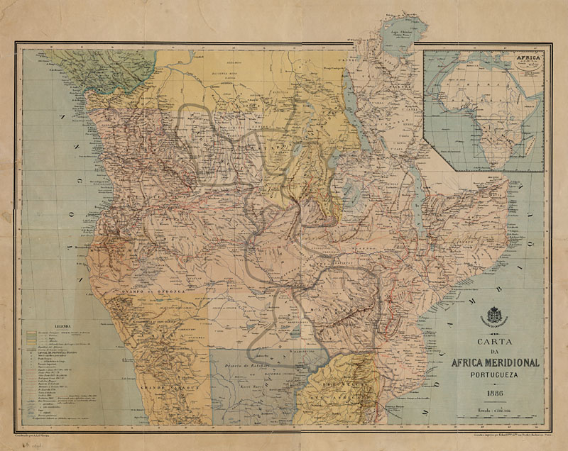
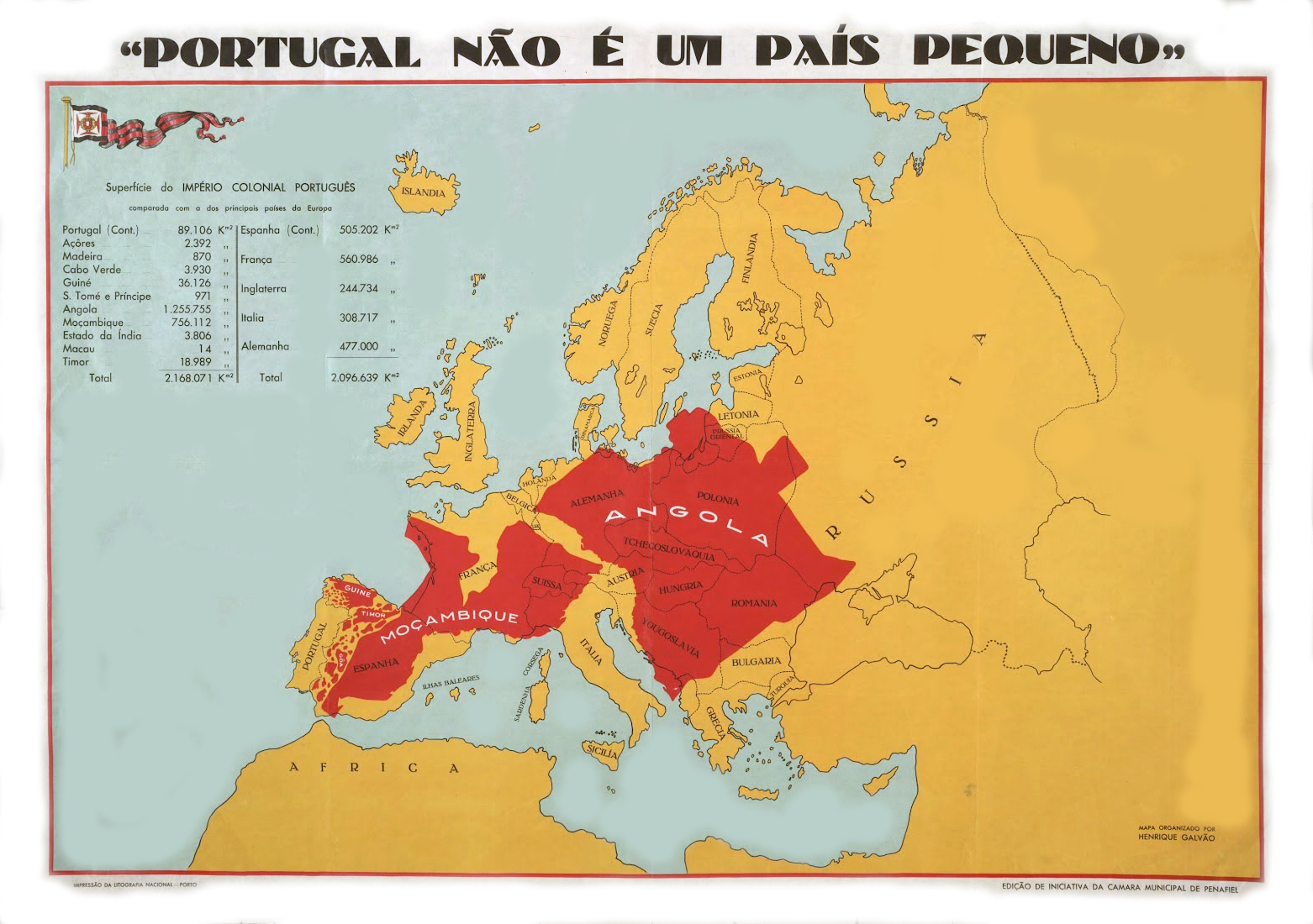
Pink Map
The “Pink Map” was the result of Portugal's counter-proposal to the division of territories on the African continent and their distribution among the other European powers, during the Berlin Conference (1884-85), in order to ensure its sovereignty over the territories of Angola and Mozambique.
This onslaught arose from Portugal's colonial need to confront the growing interest of other European countries, namely France and England, in African territories. Portugal claimed the “historical right” of occupation, but this argument was proving to be increasingly insufficient, since its colonial presence in Africa, although long-standing, was limited to coastal trading posts and very small territories around them.
So, in 1886, the map was presented by the Lisbon Geographical Society and expeditions were launched into these territories in order to maintain and extend Portuguese colonial and imperial power.
The map proposal was later withdrawn due to pressure and ultimatums from England, which wanted to implement a mega project to build a railroad that would cross the entire African continent from north to south, linking Cairo to Cape Town.
The “Pink Map” highlights the colonial ideology of expropriation and domination over the land and the colonized peoples, in a tale of the colonizer's “right” to something that has no owner.