Imagem
Associação
-
 [i]
[i]
Reflexão
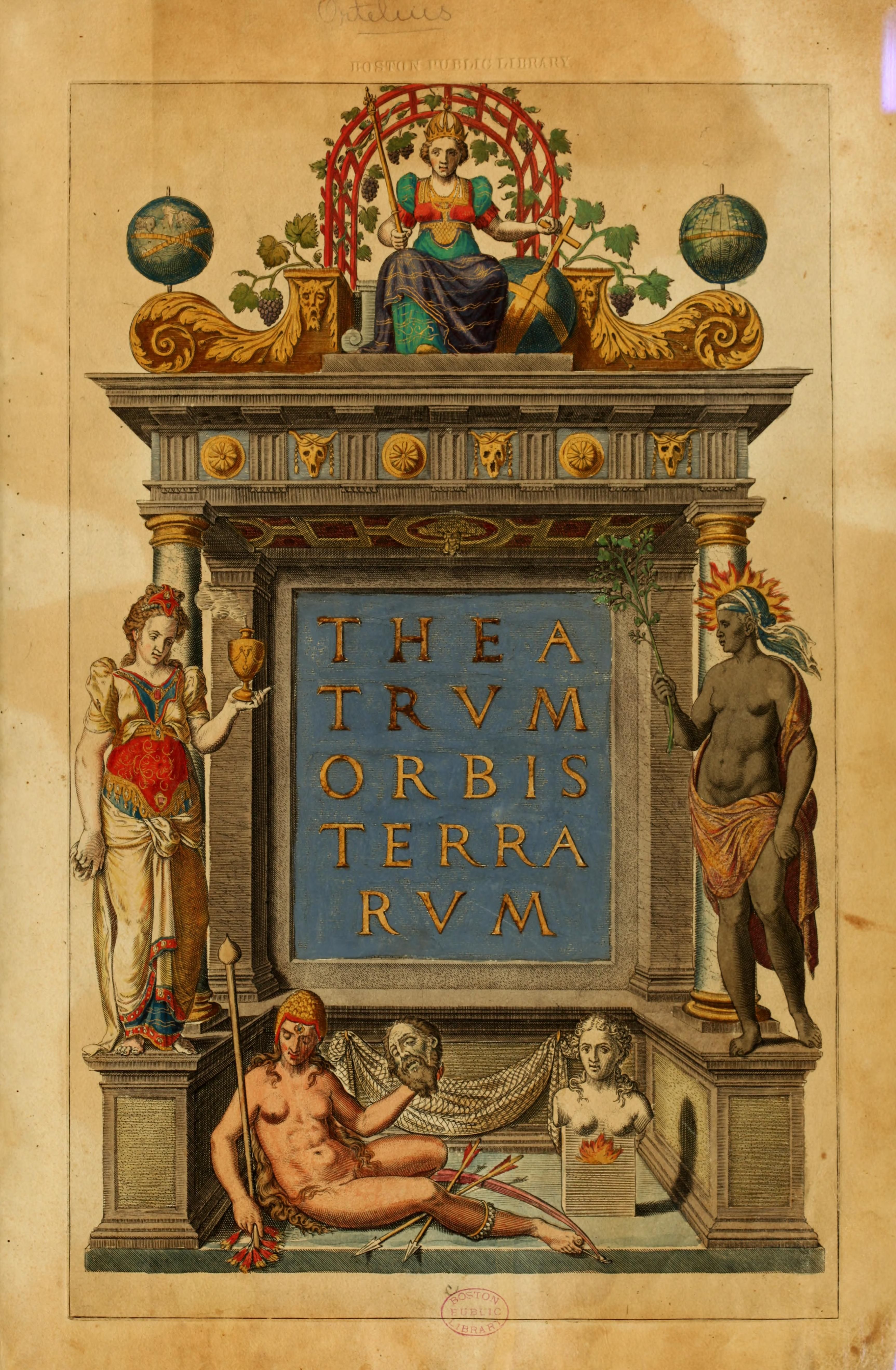
Theatrum Orbis Terrarum
Abraham Ortelius' Theatrum Orbis Terrarum (1570) is considered to be the world's first modern atlas. Semiotically, maps are not just neutral representations of space, but symbols of power and control.
Theatrum Orbis Terrarum transforms the world into a visible image, ordered and classified according to the European gaze, corresponding to the colonial gesture of “seeing in order to possess”. The work organizes the world according to a Eurocentric epistemology: valid knowledge is that produced, collected and interpreted by Europe. Regions outside Europe appear exoticized or blank, waiting to be “discovered”, “civilized” and “completed” by European knowledge.
The illustration we see here is the title page of the publication of Theatrum Orbis Terrarum, and it is highly allegorical in relation to all these ideas. The composition visually hierarchizes the continents: Europe is at the top, literally and symbolically, conveying the idea that Europe is the source of knowledge, power and global order - the gaze from which the world is mapped and interpreted; Asia (left side) and Africa (right side) appear with traces of exoticism, wealth and mystery - desirable, but subordinate. America (figure below) is shown as “savage”, without clothes and beheading a white man - which justifies, in the colonial view, the European “civilizing mission”.
The classical arch on which this whole narrative is based acts as an ideological frame, representing authority, science and Greco-Roman civilization - a heritage that Europe claims as its own. It also symbolizes the idea of entry to universal knowledge through Europe that is reinforced: the atlas is a “stage” for Eurocentric knowledge.
This is a semiotic artefact of coloniality: it creates a world in the image of Europe, legitimizes conquest, organizes space based on hierarchies of value, and silences other forms of knowledge and existence. It is therefore a map of the colonized world, but also of the colonial mind.